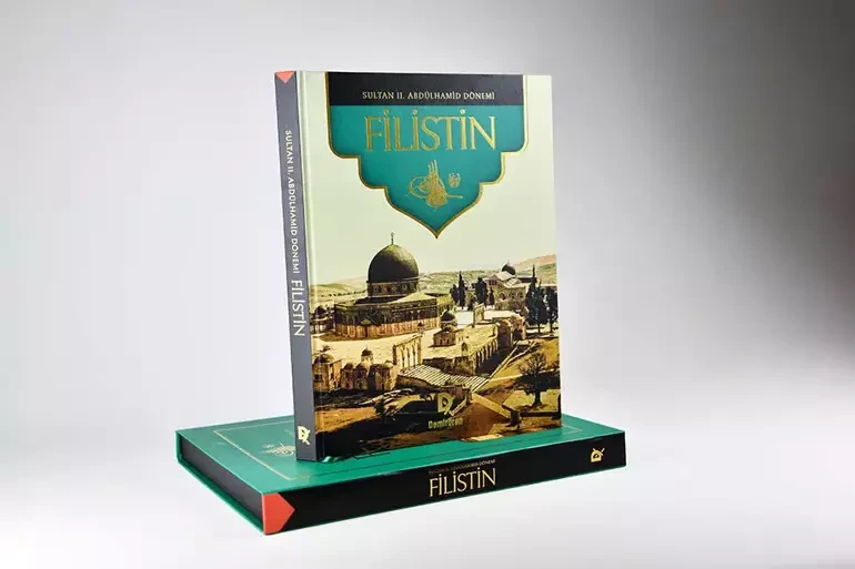
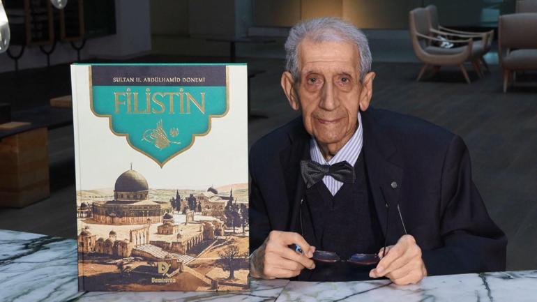
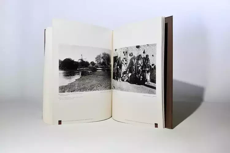
The photographs of Palestine commissioned by Sultan Abdulhamid II have been turned into a special collector’s edition. Published in a limited run by Demirören Publishing, the Palestine book features never-before-seen images from the Ottoman-era districts of Jerusalem, Nablus, and Acre.
Focusing on Jerusalem, Nablus, and Acre in line with the administrative structure of the early 1900s, Palestine in the Era of Sultan Abdulhamid II brings to light the history of Palestine through the strong archival memory of the Ottoman Empire.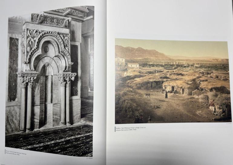
During the preparation of the work, approximately 1,300 photographs from the Yıldız Photograph Albums depicting Palestinian cities, 400 from the U.S. Library of Congress, and nearly 200 from the New York Public Library were meticulously examined.
The book includes 293 photographs—many of which have never been published before—selected for their expressive power and significance for the Palestinian region. Presented in a special box and case, the book was printed exclusively in Turkish in a limited edition of only 1,000 copies by Demirören Publishing. It offers a rare opportunity for those interested in history, connecting the Ottoman past with today’s enthusiasts.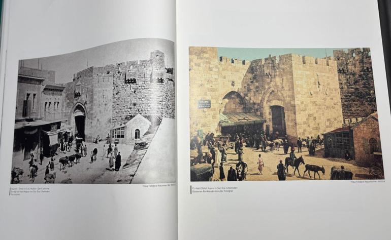
Hızlan: “An important book for understanding today’s world politics”
Writer Doğan Hızlan emphasized that understanding today’s political events requires knowing the past: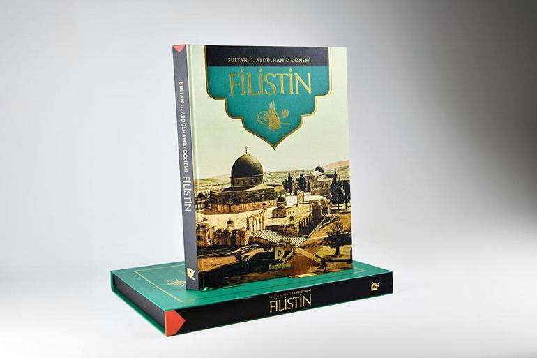
“The most important thing when recounting history is the documentary or the image. Sultan Abdulhamid II valued photography. This book does not just show Palestine under his rule, but also offers a view of the world map and Palestine’s geography, which is essential for understanding its history. These books have always been hidden treasures, revealing not only politics but also ways of life. Readers will see not only one period of the Ottoman Empire but also its development, changes, and how it was governed both within Turkey and in territories abroad. Knowing the past is essential for understanding the present, and this book contributes greatly to that understanding.”
Kaya: “The first book to bring together the geography of Palestine as visual memory”
Researcher Hasan Mert Kaya described the book as a stand-alone reference work:
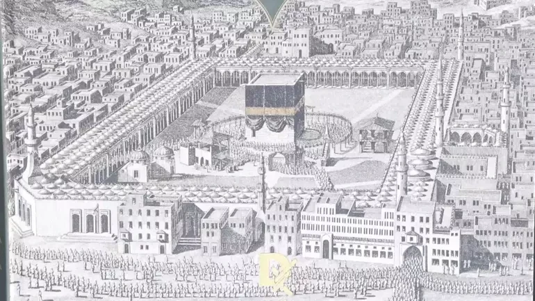
“The period of Sultan Abdulhamid II was a time when Palestine’s geography became unsettled and dynamic—a period of wars, migration, and projects aimed at keeping the region’s ties with Istanbul strong. His famous saying, ‘Every picture is an idea,’ perfectly suits this work, as nearly all the photographs give valuable insight into the architecture, culture, clothing, and daily life of the region. The book is organized into three main sections—Jerusalem, Nablus, and Acre—according to the Ottoman administrative structure of the time. This provides a clue as to how the Ottomans governed Palestine and preserves a visual record of our deep-rooted ties, architectural contributions, and their preservation. It is the first book to assemble the geography of Palestine as a visual memory and will serve as a primary reference in its field.”
Demirören Yayınları, Prof. Dr. Süleyman Berk’in hazırladığı ‘İlahi Çizgiler: Hat Sanatının Öncüleri’ adlı eseri okurlarla buluşturdu. Eser, geçmişten günümüze hat sanatına yön veren büyük ustaların hayatlarını, eserlerini ve estetik miraslarını bir araya getiriyor. Kitapla ilgili konuşan Prof. Dr. Süleyman Berk, “Hat sanatının gelişiminde bir hocadan meşk almak çok önemlidir. Bu birinci yoldur. Ancak ikinci yol da ondan ayrılmaz: Eskiden yapılmış güzel eserleri incelemek. Bu nedenle, kitabın hat sanatı yolculuğuna çıkan sanatçılar için yol gösterici olacağına inanıyorum. Demirören Yayınları da bu kitabı özenli bir şekilde basarak önemli bir hizmet yerine getirdi. Benim de temennim, bu eserin okuyucular için faydalı olmasıdır” dedi.
The book "Syria in the Era of Sultan Abdulhamid II" , featuring photographs from Ottoman-era Syria, has been presented to history enthusiasts by Demirören Publishing. Containing texts in Turkish, English, and Arabic, the book includes 200 black-and-white and colorized photographs specially compiled from the Yıldız Photography Albums, prepared by order of Sultan Abdulhamid II. The work showcases documentary photographs ranging from the construction process of the Hejaz Railway to the old streets of Damascus, from the magnificent caravanserais of Aleppo to the silent ancient cities of the desert
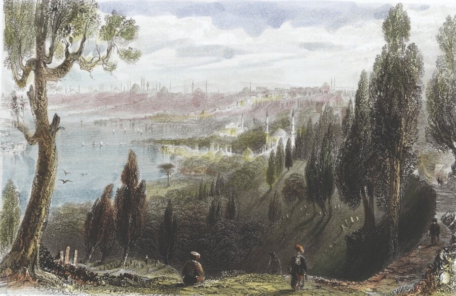
The masterpiece Beauties of the Bosphorus by English author Julia Pardoe has been republished by Demirören Publishing in a special edition enriched with 80 color engravings. Speaking about the book, Emin Nedret İşli, President of the Antiquarian Booksellers’ Association, said: “It is a very special, valuable, and rare book that depicts all the past beauties of Istanbul both through Pardoe’s writings and through the engravings made by Bartlett. With its orientalist perspective portraying the beauties of Istanbul and the East, this book has attracted great interest both in the West and in the East.”
The stories depicted on the walls of the Chora Church (Kariye Mosque)—considered the last masterpiece of Byzantine art and given its present form in the 14th century by one of history’s greatest patrons of the arts, Theodoros Metochites—have been compiled into a book. Published by Demirören Publishing, Kariye Chora: A Story of Transformation from Church to Mosque presents the narratives illustrated in its mosaics and frescoes. The bilingual edition (Turkish and English) contains 60 stories accompanied by nearly 100 photographs. Archaeologist Dr. Murat Sav stated: “The Renaissance in Italy had, in a sense, already begun in this church during the Byzantine era. Figures began to grow in size and elongate in form. There is no other building in Byzantium with such intense visual and iconographic detail. Here, there are very special elements. The mosque is surrounded by paintings and mosaics depicting some of the miracles of Mary and Jesus. Chora is a truly unique structure, and for this reason, it must be understood correctly both in a touristic and cultural sense.”
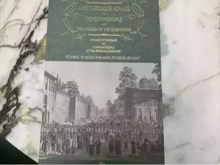
During his tenure, architect Antoine Ignace Melling—one of the rare foreigners granted the privilege of entering and depicting the harem after being received by Hatice Sultan, the sister of the sultan—created engravings of Istanbul and the Bosphorus shores, preserving the natural appearance of 19th-century Istanbul for future generations. Melling compiled these engravings, which vividly reflect the spirit of the era, into a book published in France in the early 1800s. Demirören Publishing has now released a facsimile edition of this work, published in Turkish, English, and French.
The history of the Krepen Passage has been published under the title Where is Krepen Passage? , accompanied by numerous documents and images—many of them published for the first time. In this work, author Ümit Nar, through Turkuaz Sahaf Publishing, revives a forgotten scene from the history of Beyoğlu with the meticulousness of an antiquarian. The book narrates in detail—like a “paper archaeologist”—the Krepen Passage, known today as Aslıhan Passage, with its restaurants, tradespeople, antiquarian booksellers, regular patrons, social events, and its contributions to Beyoğlu’s literary and cultural life.
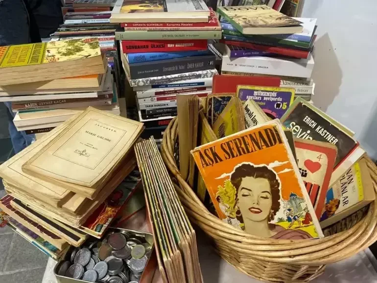
At the Sahaflar (Antiquarian Booksellers) Festival held in Üsküdar Square, around 43 antiquarian booksellers set up stalls. Visitors from various regions—including İzmir, Ankara, the Turkish Republic of Northern Cyprus, and Erzurum—flocked to the event. Emin Nedret İşli, President of the Antiquarian Booksellers’ Association, said: “As antiquarian booksellers, we are very pleased with this event. Rising book prices have affected the book trade in general, but for antiquarian booksellers the picture is somewhat more optimistic. Some books in second-hand shops, especially out-of-print editions, can be more affordable compared to the current prices in the new book market. Interest in antiquarian bookshops has been growing, particularly among young people, students, and dedicated book lovers.”
.png)